A Foundation of Effective Planning
Accurate hazard information is a foundation for effective planning and helps ensure decisions made regarding development keep people and property safe.
In Ontario, municipalities and Conservation Authorities are responsible for ensuring development is protected from natural hazards, including flood and erosion hazards. The public interest of protecting people and property from flood and erosion hazards is reflected in provincial policy (e.g., Conservation Authorities Act, Provincial Policy Statement) and locally in municipal policies (e.g., Official Plans, Zoning By-Laws).
Municipalities also have a responsibility under the Planning Act to direct development away from hazards and consider these hazards when planning infrastructure.
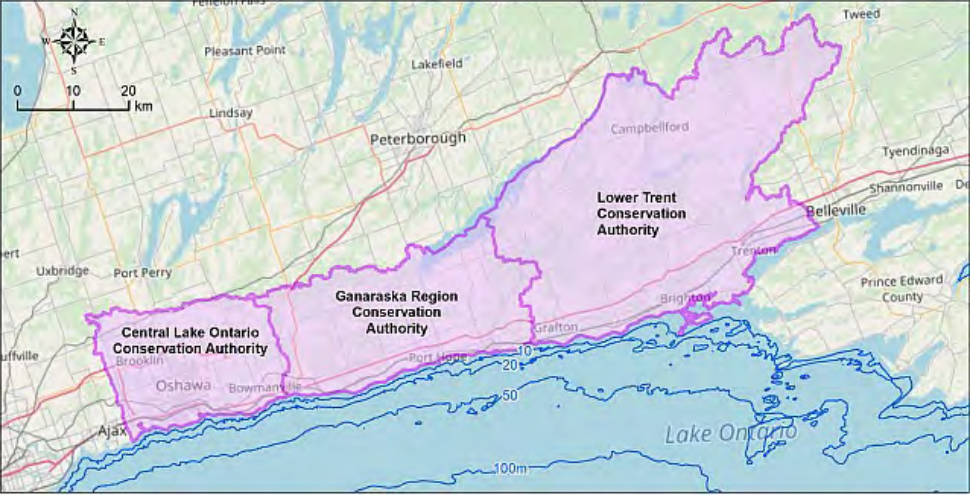
GRCA Hazard Mapping
The GRCA develops hazard mapping that identifies the location of hazard areas to support the regulation made under the Conservation Authorities Act Regulation (Development, Interference with Wetlands and Alterations to Shorelines and Watercourses, Ontario Regulation 168/06).
This mapping is an important communication tool to illustrate areas affected by flood hazards, erosion hazards, wetlands, and the area of interference surrounding wetlands. These hazards are defined in text within regulations made under the Conservation Authorities Act. In the event of a conflict with the mapping, the text description prevails.
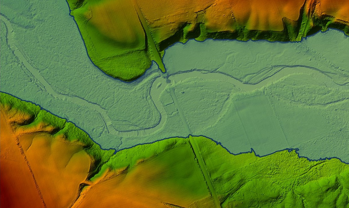
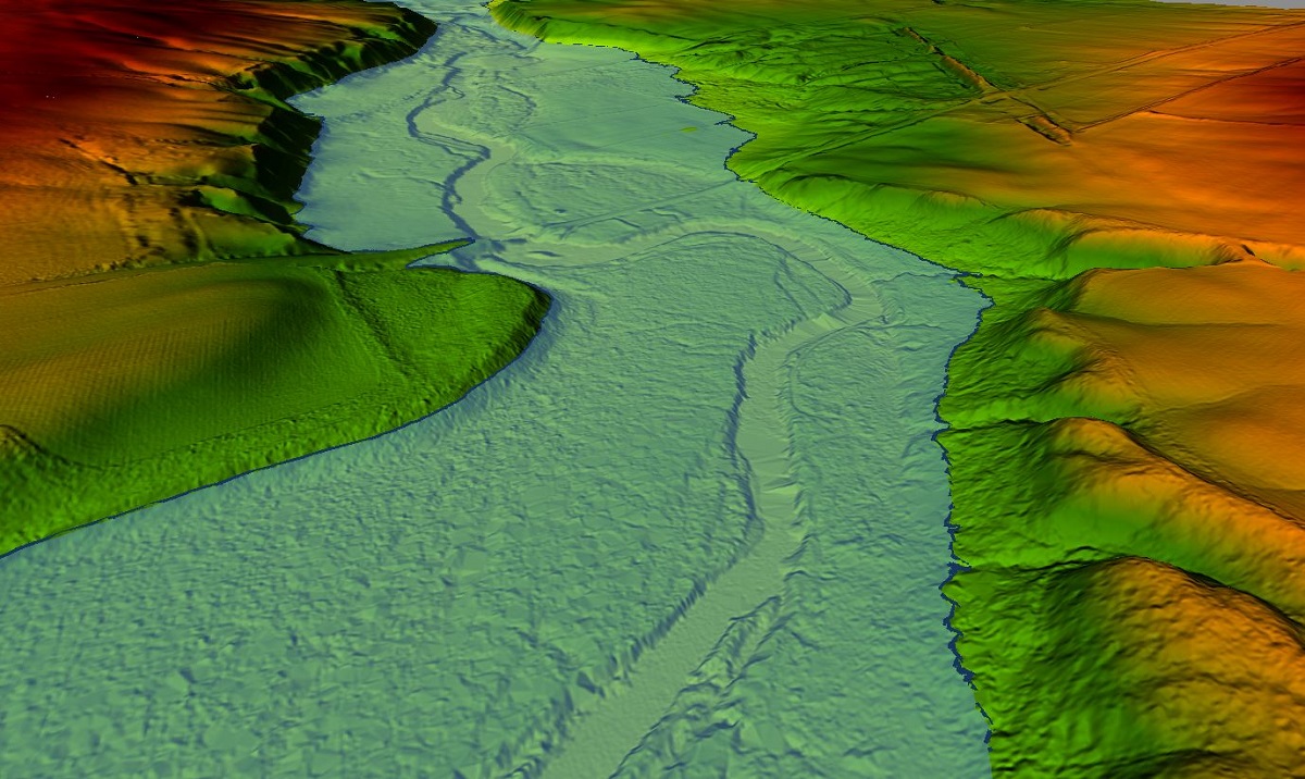
Flood Plain Mapping
Through Ontario’s Flooding Strategy, the Province has identified Priority #1 as ‘Understanding Flood Risks’. This underscores the critical need and value of up-to-date flood plain mapping.
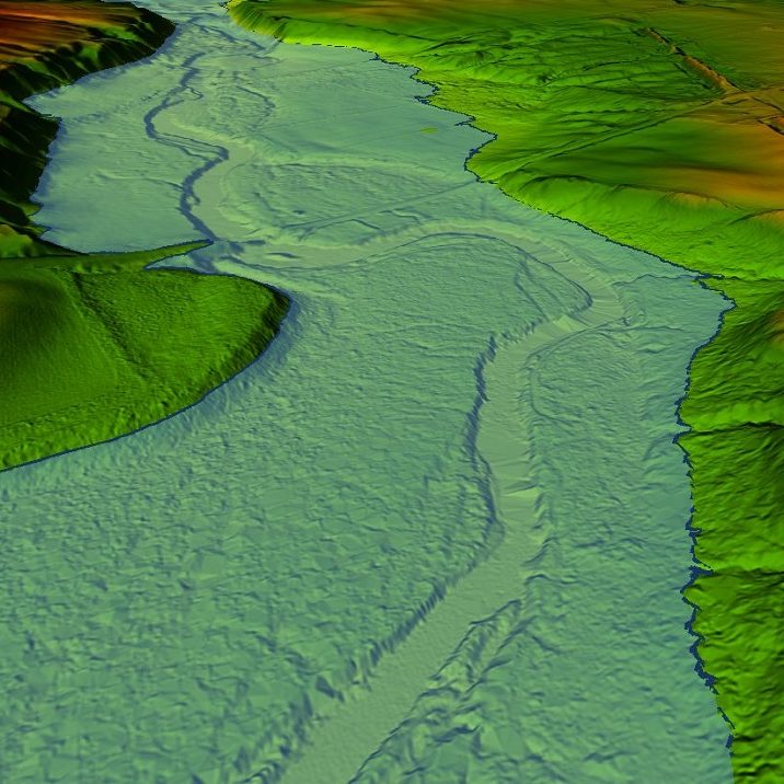
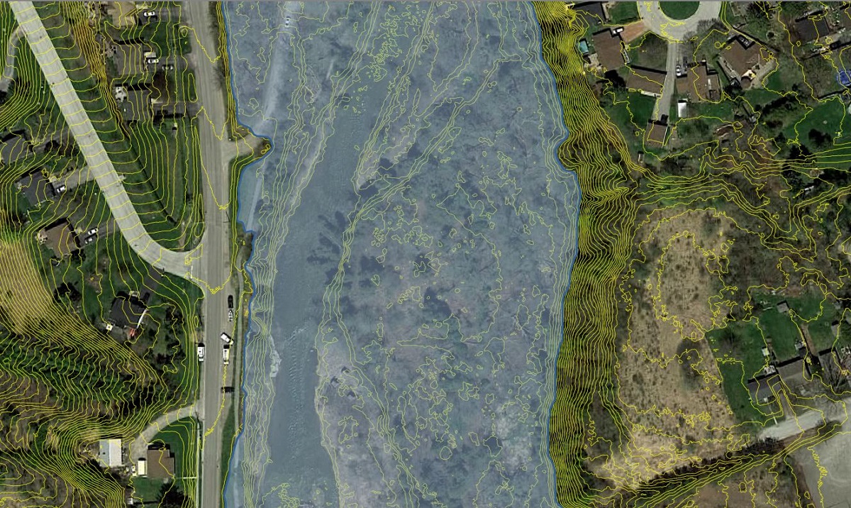
Flood plain mapping is developed using a variety of information inputs, including:
- Elevation data (from air photo interpretation, LIDAR, field surveys)
- Land use (existing and future, as determined from planning documents)
- Impervious surfaces (i.e., pavement, buildings, roads, etc. where water cannot soak into the ground)
- Flow paths for surface water runoff, tile drainage (where available), storm sewers and in-channel flow
- Observed stream flow and precipitation data
- Stormwater management plans and infrastructure
- Sizing and attributes of culverts and bridges
- Watercourse cross-sections, profiles and attributes
This information is used in hydrologic and hydraulic models to determine water surface elevations for the regulatory flood. Flood plains are modelled and mapped using detailed calculations, including how much water comes off the landscape (hydrology) and how water moves through the watercourse (hydraulics). Water surface elevations are used with ground elevation information to map the areas affected by the flood hazard.
The input data and results are confirmed by experienced professionals to ensure that the information used and decisions made best reflect the system being studied. Peer review is an important step in ensuring that the analysis meets industry and regulatory standards. Comprehensive updates such as these will go through a public consultation and stakeholder engagement process before finalizing the updated flood plain mapping.
It is important to utilize the best available information in assessing flood risks. Modelling information is used as a baseline to ensure future development proposals do not negatively impact other properties within and close to the flood plain. The information will also benefit the municipal emergency management and infrastructure planning processes.
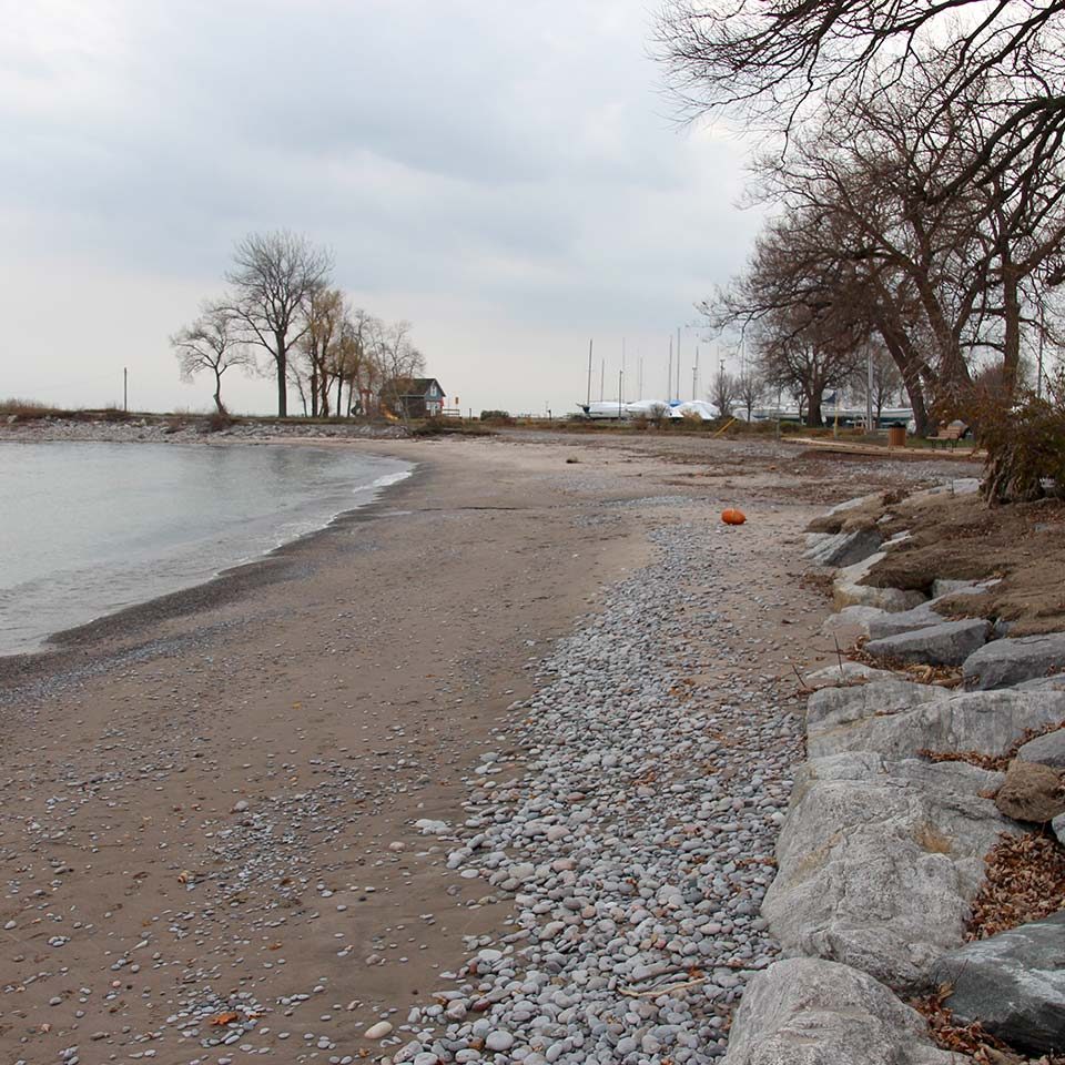
Shoreline Hazards
Hazardous lands on the Great Lakes – St. Lawrence River system and large inland lakes are defined by delineating the farthest combined landward extent of the three key shoreline natural hazards: flooding hazards, erosion hazards and dynamic beach hazards.
In the GRCA watershed, these hazards were originally identified in 1990 but were recently updated through the Lake Ontario Shoreline Management Plan.
The major goal of the Shoreline Management Plan is to provide the necessary scientific and engineering analysis to manage the Lake Ontario Shoreline. It will also increase the resilience of coastal communities, protect new development from coastal hazards, update existing hazard mapping using the best available information, incorporate nature-based solutions, protect and enhance existing private and public amenities along the shoreline, and to integrate climate change impacts when considering the coastal hazards of the future.
Effective Shoreline Management means residents, landowners, municipalities and conservation authorities have the information and tools to:
- Minimize danger to life and property damage from flooding, erosion and associated hazards along the shoreline;
- Ensure that shoreline development adequately addresses hazards through a combination of public and private management and development alternatives; and,
- Ensure that new development does not impact the environmental features and functions of the shoreline.