Current Watershed Conditions Statements
Creeks & Streams
There is currently no Watershed Conditions Statement issued by the Ganaraska Region Conservation Authority (GRCA).
Lake Shorelines
There are currently no Lake Shoreline Statements issued by the Ganaraska Region Conservation Authority (GRCA).
Reducing Risks
The GRCA maintains a flood forecasting and warning system to reduce the risk to life and damage to property by providing local agencies and the public with advanced notice, information and advice so they can respond to potential flooding and flood emergencies.
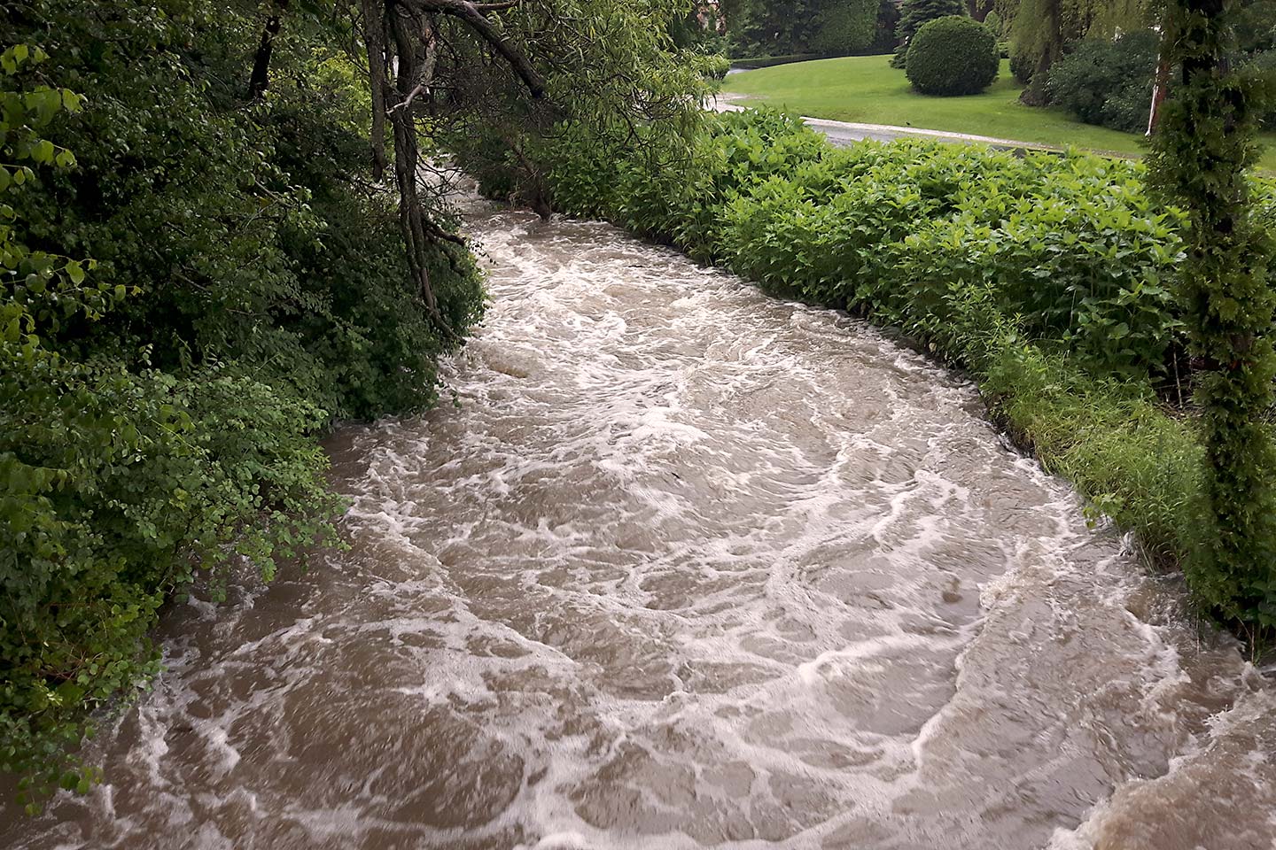
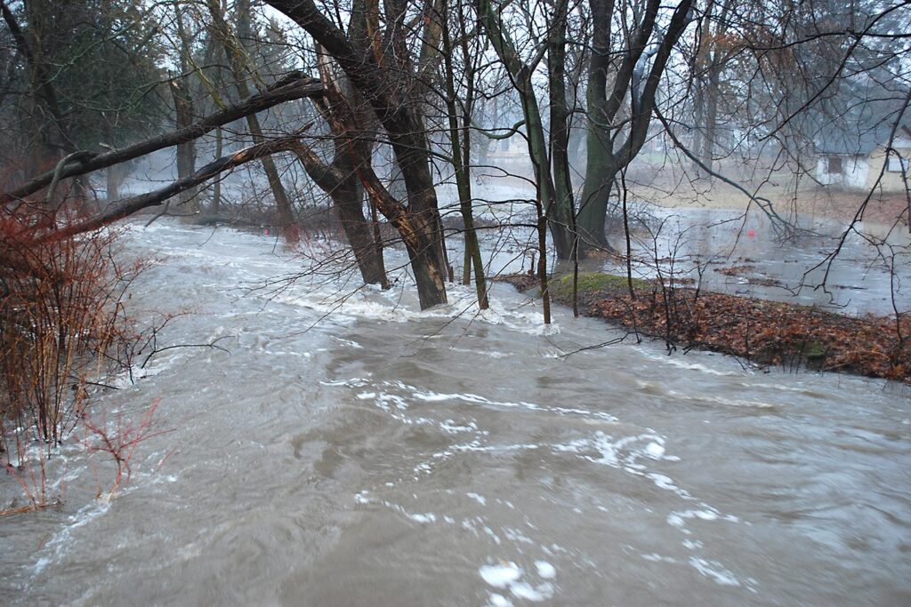
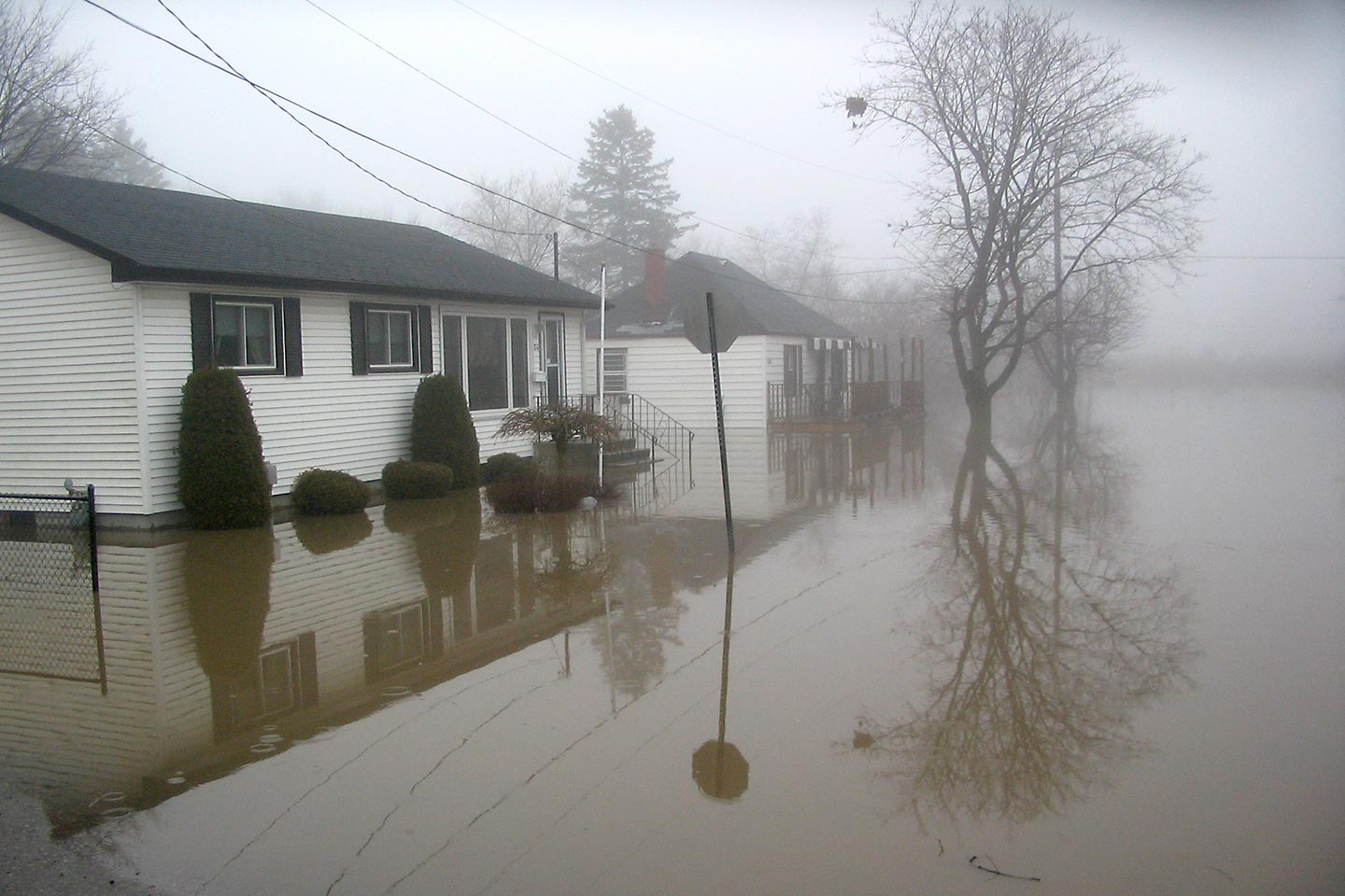
A flood is defined as a situation where water levels in a watercourse exceed the channel banks. Flooding in Ontario is a fairly common occurrence. The greatest flood in recent memory hit the Port Hope area in March of 1980 when the Ganaraska River flowed over its banks as a result of heavy rainfall on a dense snow pack.
Rain on snow is not the only type of event that can cause flooding. Hurricanes moving north from the tropics can carry heavy rainfall into Ontario commonly resulting in flooding, particularly in larger watersheds. High local rainfall associated with severe thunderstorms can cause flooding usually associated with smaller watersheds.
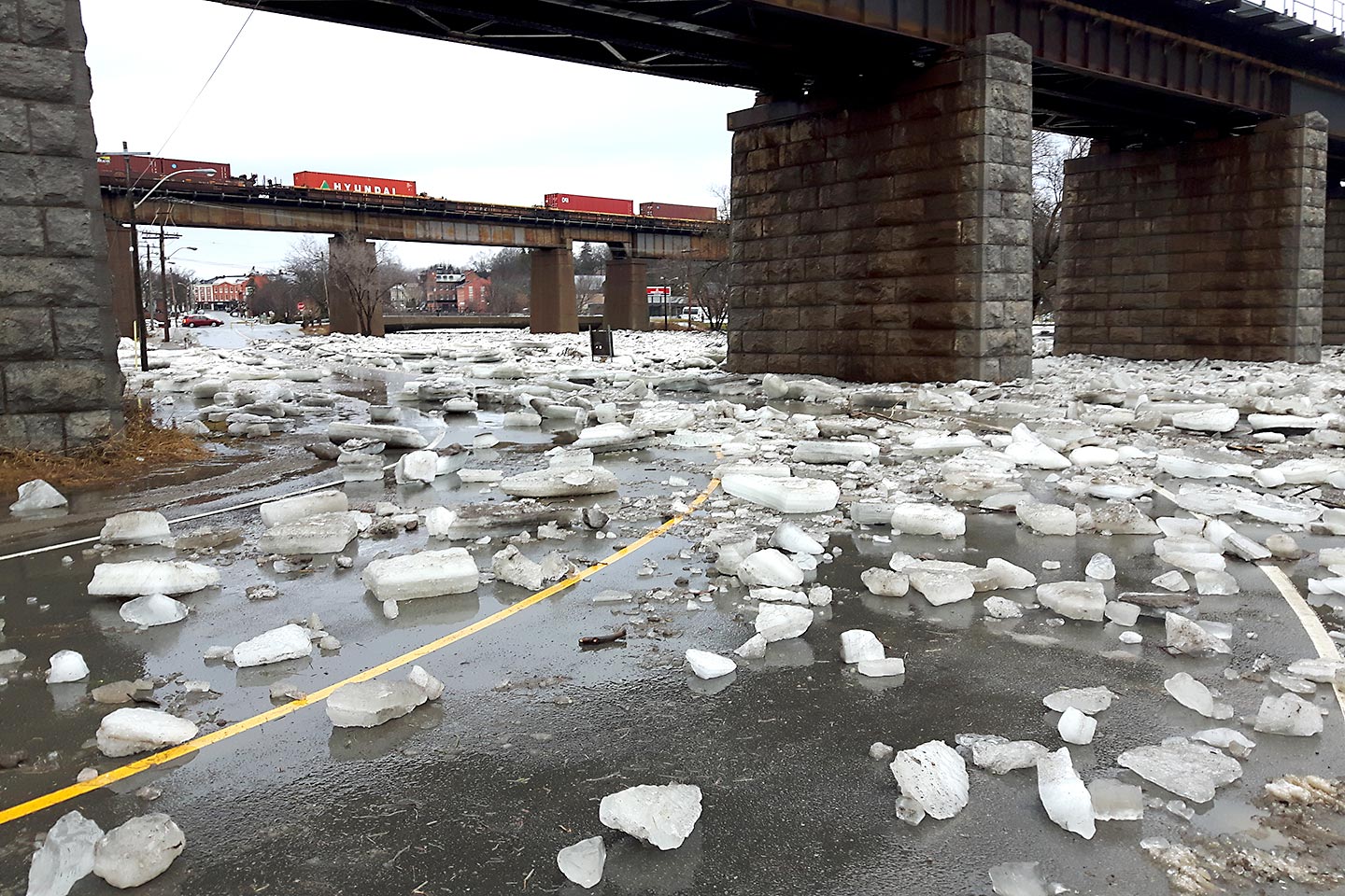
Winter ice jams associated with spring break up have also resulted in severe flooding situations. High lake levels and/or storm surges on Lake Ontario can also result in flooding along the lakeshore.
To find out if a flood message has been issued please consult the following:
- Radio, television and daily media will air flood messages
- Go to the GRCA website at www.grca.on.ca
- Call the GRCA directly at 905.885.8173, Mon. to Fri. from 8:30 a.m. to 4:30 p.m.
- Contact your local municipality
If you are concerned about flooding in your area, please contact your municipality. For emergencies requiring police, fire or ambulance, call 9-1-1.
If you would like to report flooding to GRCA, please contact our flood duty officer at 289.251.1010.
Flood Forecasting
The Ganaraska Region Conservation Authority (GRCA) operates its daily planning cycle to monitor, on an ongoing basis, weather forecasts, radar and watershed conditions at locations across the watershed.
Water level and related information is remotely collected through an extensive network of stream gauges, precipitation gauges, snow course sites and staff gauges (monitoring network). Our extensive knowledge and historic data on the watershed's responses to extreme weather and conditions in our watersheds is used to develop a flood forecast.
When conditions warrant, GRCA will communicate with local agencies (municipalities, emergency services, local media, school boards and government agencies) issuing flood messages following a standard format used by all Conservation Authorities.
During spring snowmelt or severe storms, the Conservation Authority estimates the severity, location, and timing of possible flooding, and provides these forecasts to local agencies using one of the following message formats:
Flood Status Graphics & Descriptions


Flood Event
Defined as a sudden increase in watercourse levels resulting from the occurrence of precipitation, snowmelt, or a combination of the two.
The severity of flood events can range from minor increases in creek levels (resulting in hazardous creek conditions) to extreme flood conditions (posing a risk to life and property). These various types of events, and the corresponding flood response activities, are described in the GRCA’s Flood Contingency Plan.